
Page 53 - Build 153
P. 53
The risk from rising seas
New Zealand’s long, narrow coastline is vulnerable to the rising seas climate change will bring. A national stocktake of coastal assets, including buildings, land and infrastructure, recently quanti ed this risk.
BY DR ROB BELL, PRINCIPAL SCIENTIST AND PROGRAMME LEADER: HAZARDS AND RISK, NIWA
LATE LAST YEAR, the Parliamentary Commissioner for the Environment released the report Preparing New Zealand for Rising Seas. It includes information from NIWA on the regional and national risk exposure in low-lying coastal areas below 3 m above mean spring tide. Land area and parcels, population and all types of buildings and infrastructure such as roads, railways, airports, jetties and wharves are covered.
Stocktake of assets at risk
The NIWA report National and Regional Risk Exposure in Low-lying Coastal Areas is the rst attempt to quantify the risk exposure in coastal areas across New Zealand. This enables comparisons in risk exposure between di erent regions and urban areas.
The report is a stocktake of what’s at risk within land that is 0.25, 0.5, 1, 1.5, 2, 2.5 and 3 m above the mean spring tide level.
Risk exposure for this study is expressed as counts of normally resident population, areas of land parcels and numbers or lengths of built assets or infrastructure within these elevation bands. The asset information comes from national databases in RiskScape, a joint venture project by NIWA and GNS Science.
Some areas missing accurate elevations
Resolving areas of coastal plains with such small increments in land elevation requires very accurate topographical data.
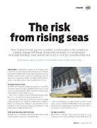
Adding coastal erosion protection along the Kapiti Coast.
There are substantial areas of high-resolution elevation coverage across coastal areas mainly from LiDAR (light detection and ranging), a laser-based aerial scanning method for measuring elevations. However, some stretches of coast are still not covered.
Top exposure regions
Figure 1 shows a summary of the risk exposure in the 0 to 1.5 m elevation zone across regions with high-resolution LiDAR datasets
Hazards
Build 153 — April/May 2016 — 51
FEATURE SECTION
PHOTO – DAVE ALLEN, NIWA
